Subscribe
Posts
2026
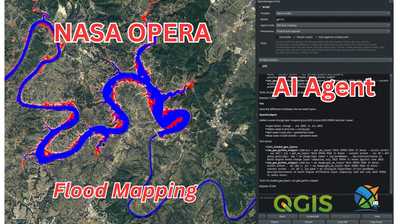
May 5, 2026 – A step-by-step tutorial on installing the NASA OPERA QGIS plugin, searching DSWx surface water products, and using an integrated AI agent to analyze flood events.
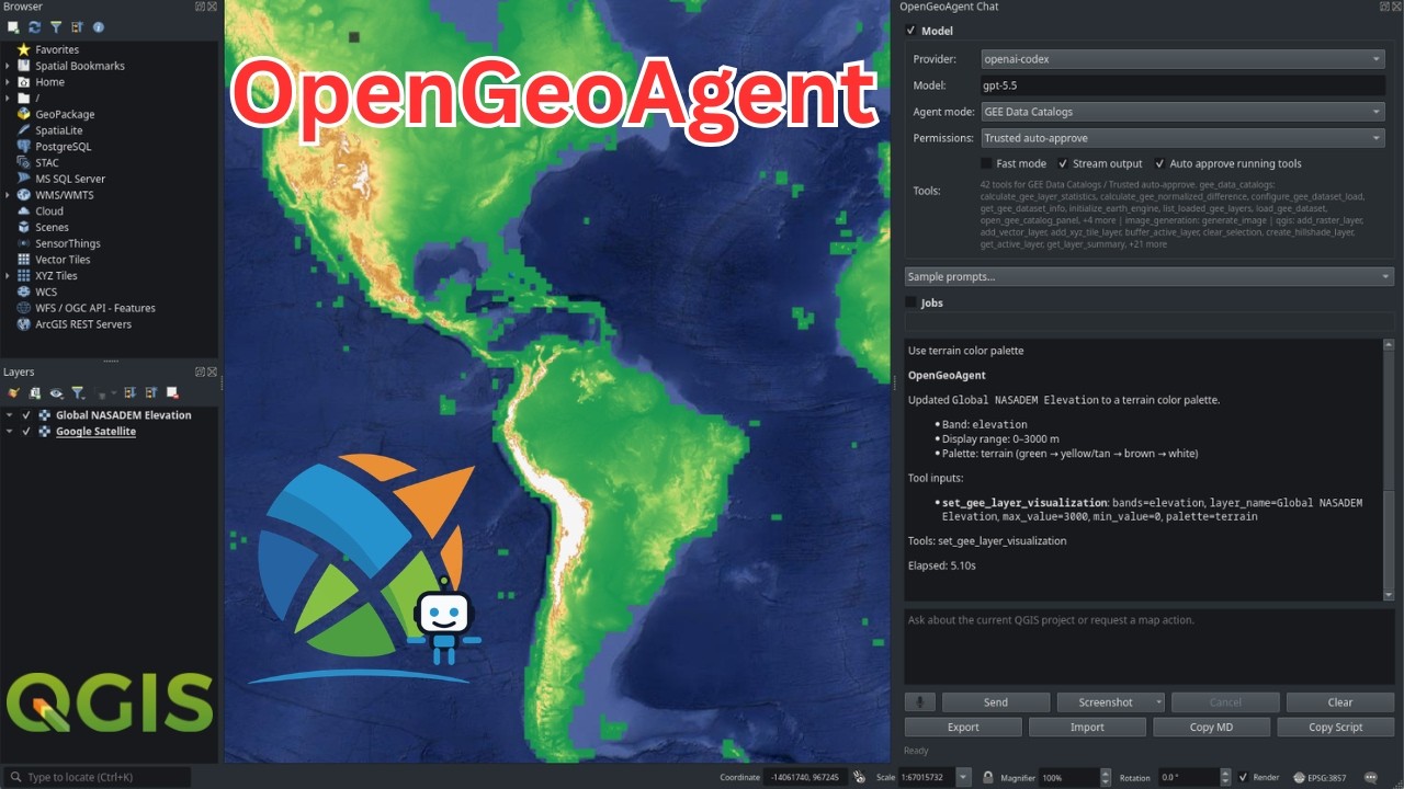
May 3, 2026 – Introducing OpenGeoAgent, an open-source multimodal AI agent that automates geospatial analysis and visualizationthrough natural language.
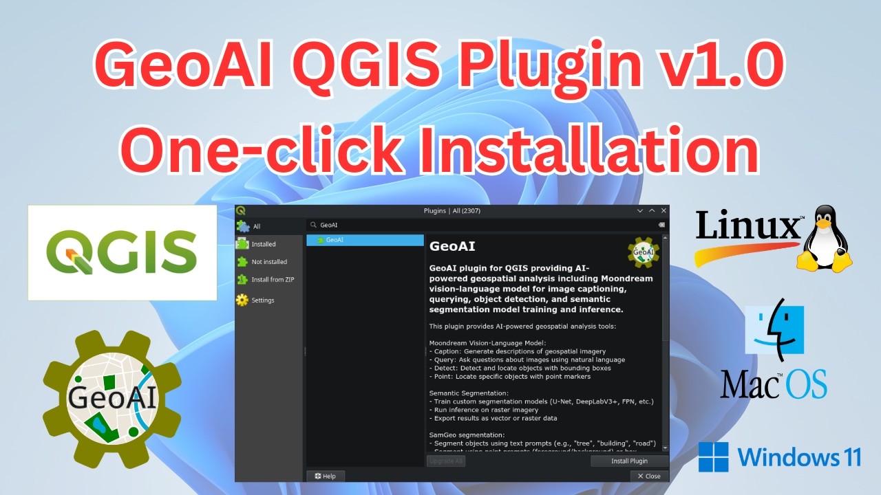
February 25, 2026 - Announcing GeoAI QGIS Plugin v1.0 with one-click installation, SAM 3, water segmentation, forest segmentation, and export to vector, raster, COCO, YOLO, and Pascal VOC formats.
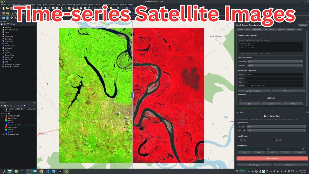
January 21, 2026 - A step-by-step tutorial on creating and downloading time-series satellite imagery using the GEE Data Catalogs Plugin v0.5 for QGIS, with no coding required.
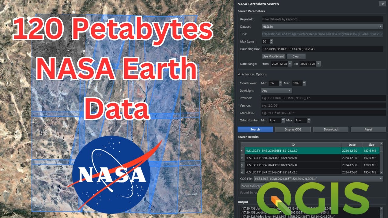
January 6, 2026 - A step-by-step tutorial on using the NASA Earthdata QGIS plugin to search, preview, and download satellite imagery and geospatial datasets from NASA’s archive without programming.
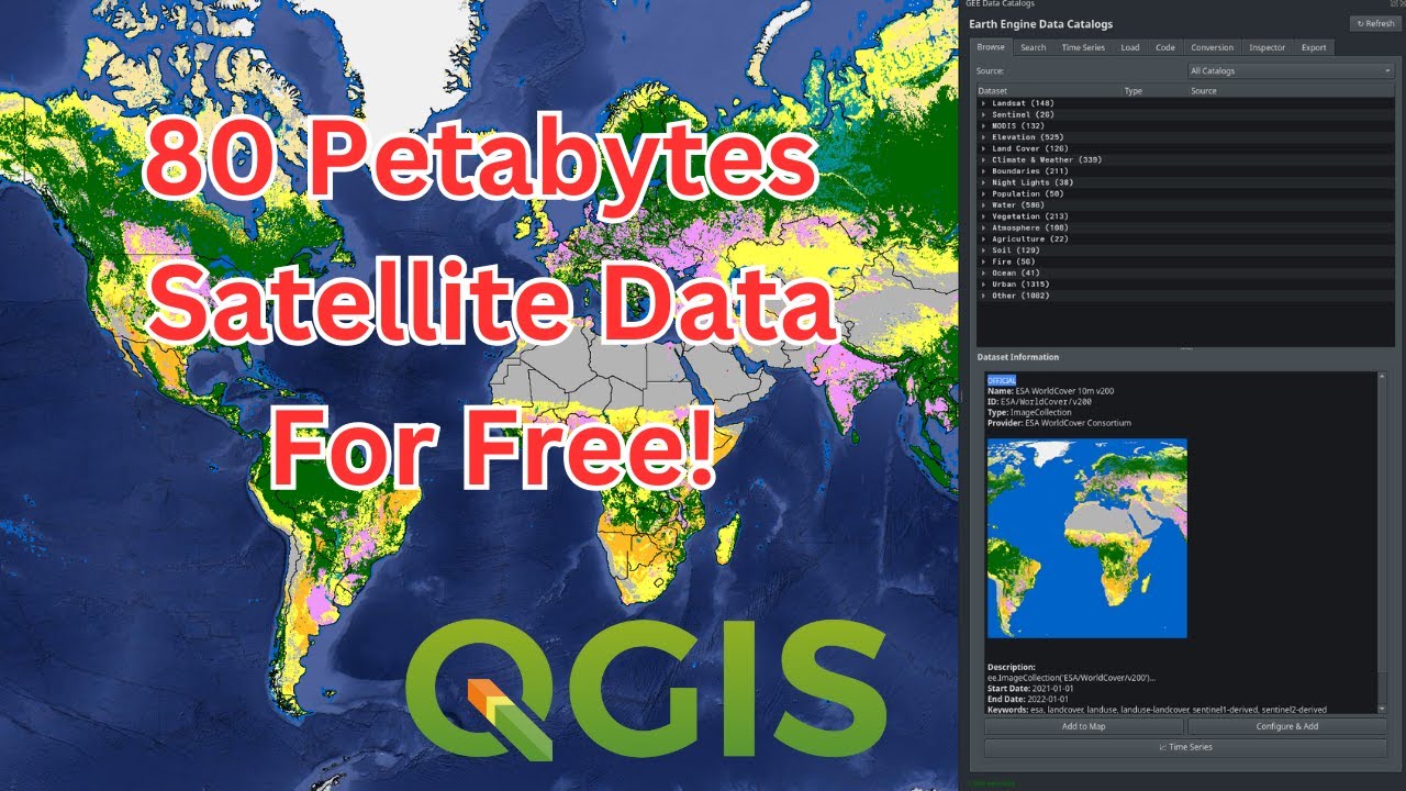
January 3, 2026 - Introducing the GEE Data Catalogs Plugin for QGIS, providing access to over 5,000 datasets from the official Earth Engine catalog and the Awesome GEE Community Catalog with no coding required.
2025
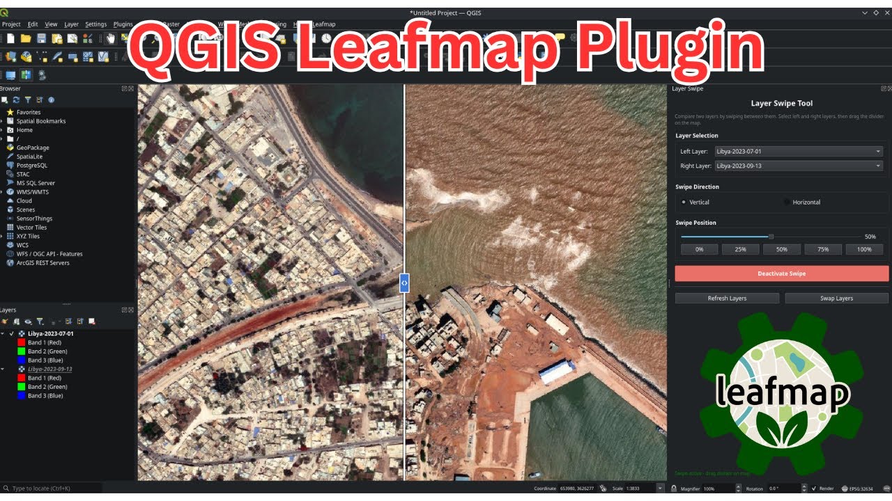
December 30, 2025 - Introducing the LeafMap QGIS plugin with interactive layer transparency controls and a swipe tool for comparing geospatial layers side by side.
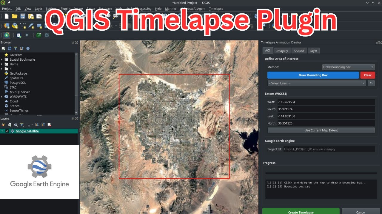
December 27, 2025 - A step-by-step tutorial on using the QGIS Timelapse Plugin to create animated GIF and MP4 timelapse videos from Landsat, Sentinel, MODIS, GOES, and NAIP imagery powered by Google Earth Engine.